
I would begin my post with a story how SAS lost my luggage. Because of that, I had to spend one more day in Kiruna before starting my hike, and so I was forced to cover more per day during my hike to keep up with the schedule.
The guy in Kiruna Airport said that it is pretty common when SAS doesn’t deliver luggage in time, so if you’re planning your hike and going to Kiruna by plane, you should probably consider staying in Kiruna for two days in case your luggage is delayed.
The funniest thing is that I was not the only one whose luggage was not delivered in time. Two guys from Germany were on the same flight with me and one of them didn’t get his backpack as well. So it is really pretty common, beware!
Okay. So, the Kungsleden.
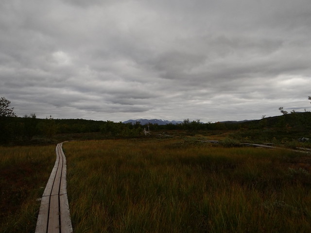
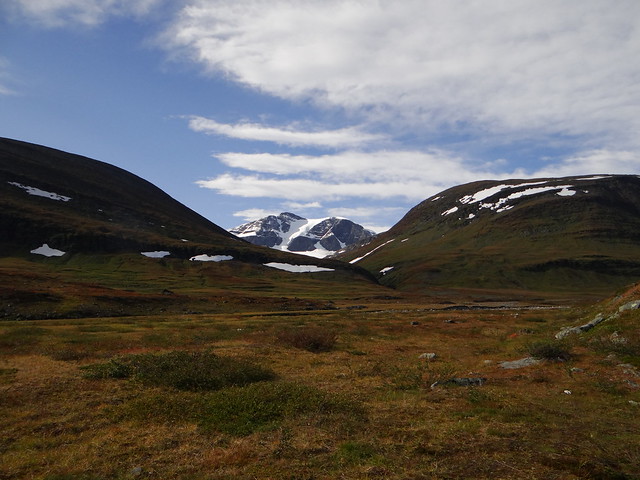
This is the most comfortable and easy trail I had in my hiking life so far. The terrain is pretty flat and easy to walk. In the wet areas there are dikes, so you would not wet your feet. Every river and a brook has a bridge to cross over, so you don’t need to wade your way through the ice-cold water like you normally do in Scandinavia. The trail is visible and well-marked, and there are signs every now and then so you wouldn’t get lost even if you’re not skilled in outdoor navigation. I would certainly recommend it as a trail for beginners. If you’re planning your first solo hike you should consider Kungsleden as a comfortable and safe trail to do.
Trail stations/huts operated by the Swedish Tourist Organisation (STF), stationed every 10-15 Km of the trail are the most comfortable I ever encountered. Some are manned, with a shop, where you could buy food and some hiking stuff. Food includes such uncommon products as olives and a beer. You could also dump your waste at the stations which is really convenient.
Pitching the tent in the area of Abisko national park is permitted only in designated places (near the stations) but the park territory is rather small. It stretched from Abisko Station roughly to Abiskojaure.
Okay, here is my hike diary.
1st day
I arrived to Abisko Station by bus from Kiruna at 9 at the morning. Abisko station has a shop where you could buy essentials like gas cartridges (they sell Primus Power Gas), food, some clothes and other hiking stuff (most of it by Fjallraven), they also sell maps of the area as well. The shop is open daily 8-20 which is super convenient. If you have any questions you could reach them by email and they are responding pretty quick.
Abisko station hosts one of the best restaurants in Sweden Lapland and I recommend visiting it at the start of your hike. Unfortunately, since I was off-schedule I had no time to enjoy the meals at the Kungsleden Restaurant. Abusko Station has a special place where you could fill your thermoses with hot water and your flasks with cold, which is super convenient.
So roughly at 10 at the morning I left the Abisko station and headed to the Kungsleden. The weather was nice, about 19C and light wind, some clouds but no rain. I love the autumn (or should I say Indian Summer?) in Lapland. Although you could get some nasty weather chances are you’ll have a +20C and sun which is perfect for the hike.
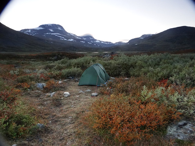
I did about 10 km at the first part of the day, had my midday snack near the beginning of Abiskojaure and continued forward. The terrain was easy, as I said before, and I did some 5 km more. There is designated tent place at the foot of the Garrdenvarn hill, but I decided to do some more that day and continued up the hill. The hill is pretty steep on its north side and I was tired so it took me a while to climb up. Initially, i thought that I will make it to Alesja that day, but that was obviously too much. At the SW foot of the hill, there is a winter Sámi settlement, abandoned at summer. It is allowed to pitch a tent there so I made it my final stop for a day.
The sunset was spectacular and the atmosphere of the settlement of reindeer herders was mysterious and calm. The only problem, however, was that there was no running water, just a small pond. I decided that the water is OK to boil and cook food but I didn’t risk to drink it raw. Fortunately, I had enough water stocked so that was not a problem.
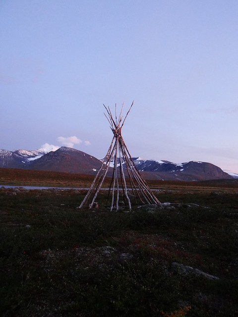
This is traditional Sámi dvelling place called Goahti, the poles could be covered with fabric (or, in early times, with reindeer skins) and in the middle of the construction a small fireplace is stationed.
The night was pretty cold because of the humidity coming up from the pond. It was not particularly cold but since everything was kinda wet I had some troubles sleeping.
2nd day
It is hard to me to wake up early after the cold nights, I must be a cold-blooded creature cause I can’t make myself crawl out of my tent in the chill of the morning. So I usually sleep in my tent until the Sun rises up enough to warm the tent and its surroundings. This brings more comfort to my mornings and I’d rather walk long hours in the evening, and go to sleep after the sunset than rising early and start my hike at the sunrise.
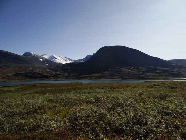
The weather was beautiful. Sunny, no clouds (I put on my shorts and T-short) and the trail was going near spectacular lake system. There is a boat transport from Jadujavri to the Alesja station, operating during summer, so you could shorten your walk for some 8 km and make it by boat if you want.
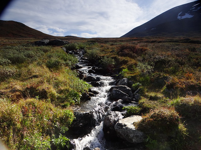
This part of the trail is marked by splendid of springs running from the surrounding mountains and the water is super clear and tasty. To drink from a running water is one of the things I love in hiking. I have my kuksa stuffed on my belt so every time I cross a nice stream I fill it with ice-cold and tasty water.
This is another good thing about Kungsleden (and Lapland in general) I should mention. There are no sheeps, which are common in central/fjord Norway and Iceland so it is safe to drink from a running water whenever you encounter it. Sheeps are known for spoiling the water with their feces, so sometimes their presence could become a problem.
On the other side of Alisjavri lake, there is another Sámi winter settlement, which looks quite scenic in the sunset sky.
I set my tent on the designated place near the Alesja station. It was a big manned station/hut, with a good shop, selling beer. I couldn’t resist the temptation a bought a can of beer )
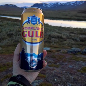
This was the most remote place I ever had beer in )
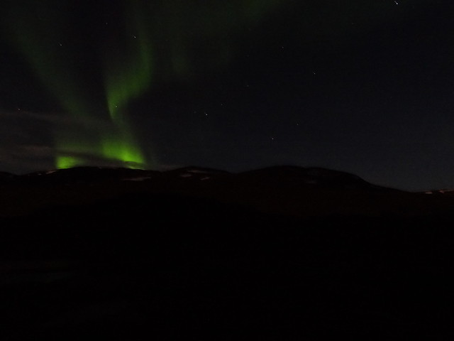
The night was good, although there were thousands of mosquitos outside. Since the sky was clear I set my alarm clock at around the midnight to check on Aurora, and – hooray – I had a glimpse of one )
3rd day
The weather was nice, sunny although windy. The road from Alesja to the next station, STF Tjäktja is less flat than the previous parts of the trail. There are some parts where there are boulders on the ground, but it is manageable. My initial plan was to reach Tjäktjapass and set my tent on the pass, but when I reached the pass I decided that it was a bad idea. The pass was one of the windiest places on all the Kungsleden and there literally was no place to pitch a tent.
The pass is equipped with STF emergency cabin, where you could wait out the bad weather. Overnight staying in the cabin is permitted in an emergency only.
The pass lies appr at 1100 meters and there is the quite steep 300m ascend on the Abisko side, and quite steep descend on the side of the Tjäktjajakka valley. The road down mostly is a windy maul trail with occasional boulders here in there. Although you don’t need trekking poles on the flat roads of Abisko, here they were a great help for me, because the way down was really steep and slippery because of the rain.
So I decided to go past the pass, and pinch my tent down in Tjäktjajakka river valley. I decided that I would go forward to Salka station, but if I didn’t make to Salka before the sunset, I set my camp somewhere in the valley.
The Tjäktjajakka valley is a super-windy place. The mountain ranges on both sides of the valley act like a gust tunnel, the wind is strong and changes directions unpredictably. This is particularly nasty when you have to pitch your tent (and when your tent with a high windage, like my Terra Nova Solar Competition). Fortunately, there are lots of spare boulders I used to keep the tent in place.
The night was windy but relatively warm, I’d say it was about +2C outside which is okayish for me.
4rth day
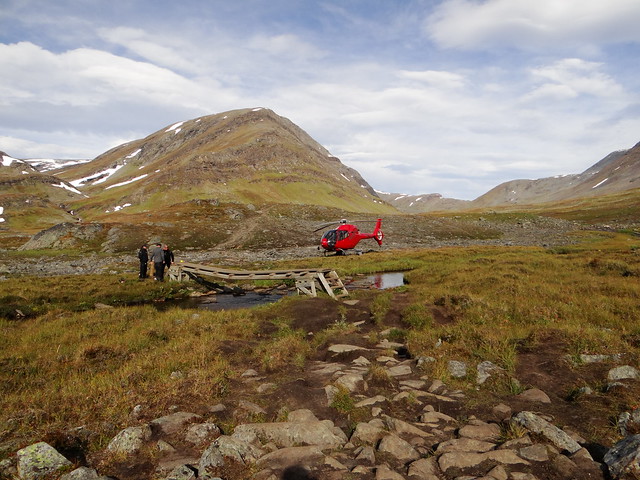
While I packed my tent and my belongings I heard a helicopter approaching. It was fascinating to see how skillful the pilot was, maneuvering the vehicle in the narrow valley.
Turned out the helicopter belonged to the Kunglseden rangers. They came to the valley to fix the small bridge over a little river/brook.
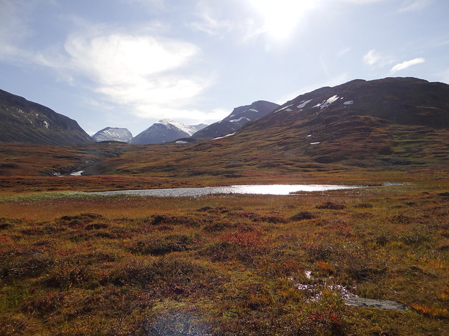
As I said above, the Tjäktjajakka valley is quite beautiful, although windy. The mountains around the valley are covered in snow, shining under the sunlight, the river makes picturesque turns here and there.
the road to the Salka Station is quite easy. It was sunny although windy, and I was glad I had such good weather for 4 days in a row.
STF Salka is a nice manned station, located in the valley. It is smaller than the Alesja station, but it features a shop and a separate waste collection station you could use. I had my afternoon tea at the station and then proceeded forward to SingiStugan, which was the meeting point with my boyfriend.
The valley between the Salka and Singi is filled with small rivers and there are reindeers roaming in the valley. In the middle between Salka and the Singi, there is a Kuoperjakka shelter/cabin (available for emergency overnatting). There are nice places to place a tent near the Kuoperjakka, so you could make it your destination for a night. I had my lunch near the cabin and then proceeded forward to Singi.
For some reason this day I felt tired, so the last part of the way was quite challenging. My speed decreased and it was pretty late when I reached Singi. Singistugan is a small and unmanned hut, with a dedicated tent place. Since it was the meeting point with my boyfriend I set my tent in the dedicated tent space.
At the evening the weather gets cold and very windy. You could see that strong winds are common in this place by a number of stones gathered at the tent place. Some of them were clearly used to make windshield, some to hold the tent in place. That was quite useful for me since, as I mentioned earlier, my tent is very prone to flying like a kite )
The night was probably the coldest of all, temperature clearly dropped below the zero. As my boyfriend, who spend the night some 15 km from my place, noticed ice in the morning, so it was really cold.
This was the first night I regretted I didn’t have a chemical thermal pad with me, I would clearly use one. Because of the cold, I had some troubles sleeping and get good sleep only well past midnight. Strong wind contributes a lot to the overall cold, I guess it would be okayish if the air would be calm, but continuous gusts literally blew out all the heat I generated inside the tent.
That was the last night of my solo hike. At the morning I was wakened up by my boyfriend who made it to the Singi already.
I would wrap this tale now, since after that it was not a solo hike anymore. I would only mention that due to the bad weather condition we didn’t make it to the top of Kebnekaise as was planned.
BTW the Kebnekaise mountain station is a super comfortable place with a great restaurant, if you’re interested in visiting the Kebnekaise only you could book a bed at the STF Kebnekaise and spend your nights there.

There is also a nice day-trip to the Tarfala which is would recommend. Tarfala is beautiful but hostile windy place near the glacier (which lies on top of the mountain system Kebnekaise is part of).
So… I guess that’s all for now )
You could see my trail on Wikiloc
More photos from the hike are on my Flickr
